There were six of us on the tour plus a guide (who was totally kooky, but who did a great job and taught us a lot) in a small bus. The Golden Circle Tour, called the Golden Circle for the loop you do around the southwestern part of the island, is the most popular tour with tourists in Iceland. I can understand why! Even though everyone does it when they come to Iceland, it's not a tourist trap; it's just the best way to see some of Iceland's coolest sights!
Iceland is a volcanic island with lots of volcanoes. Almost all the land is made of hardened lava and volcanic rock, so the terrain is very different than anything I've seen before. The island also sits on both the North American and the Eurasian tectonic plates, so it's really been shaped by their movement. The first area where we stopped was in a volcanic area just to see the scenery.

It wasn't freezing, but there was still snow in the area where we were standing and of course there is snow on almost all the mountain peaks.

The road we drove on through the volcanic area. Apparently J.R.R. Tolkien was inspired by Iceland before he wrote Lord of the Rings and Peter Jackson considered using Iceland to shoot the films before ultimately choosing New Zealand (probably because it was warmer).

Looking out across the land to the largest freshwater lake in Iceland. It's extremely clean and is fed by underground lakes.
From this area we also saw some of Iceland's geothermal power plants. Almost all of Iceland's power comes from the boiling hot water under the earth; something like 85% of Iceland's energy is green. All of the homes in Reykjavik are heated by geothermal energy.
Since the water of the lake, and most of the streams and rivers, comes from underground, the water is extremely blue and extremely clear.

The lake (which has a totally unpronounceable name, just like almost everything in Iceland) was really beautiful. There were also tons of amazing summer homes on its banks.

Sheep grazing in a "field" in front of the lake. Apparently things get greener in the summer, though not really green. Stuff was mostly brown for us, but it was still amazing.
Our next stop was in the Rift Valley, which is the area between the two tectonic plates. There are about two kilometers between the two plates and they move apart a few centimeters every year. We stood right on the edge of the North American plate and then walked across the valley to the Eurasian plate. This area is also the sight of the first Icelandic Parliament, which started meeting in the 800s. They did all their governing in this area for centuries.

Looking over part of the Rift Valley and the freshwater lake.

The Valley. Straight across you can see a dark line - that's the edge of the Eurasian tectonic plate. I was standing on the edge of the North Atlantic plate when I took this photo.


The cliff that makes up the edge of the North Atlantic plate.

More of the Rift Valley.

The edge of the North American plate again and a freshwater pool. Back when Parliament met in this area, this is the pool where they would drown women convicted of crimes. Men were beheaded and women were drowned because apparently drowning was a "gentler" way to die. I don't know, I think I'd take decapitation over being tied into a sack and thrown into ice cold water to drown.

A different, non-killing stream.
Our next stop was actually at the edge of the freshwater lake so we could taste the water. The water is so clean that it does not need to be purified in any way - and it definitely tasted that clean. It was also extremely cold.

The lake. There are some circle patterns in the water kind of in the front center and a visible hole; that's one of the areas where the water comes bubbling up from the underground rivers.

Karen filling up her water bottle. Look how clear the water is!
As we were driving, there was also just lots of awesome scenery that we didn't stop to see:


And there were some horses that we did stop to see! Icelandic horses are important to the country and are quite different than American horses. They're smaller - they look more like ponies - and very solid. They also have goofy manes.

They all ran up to the fence when we walked over to it.
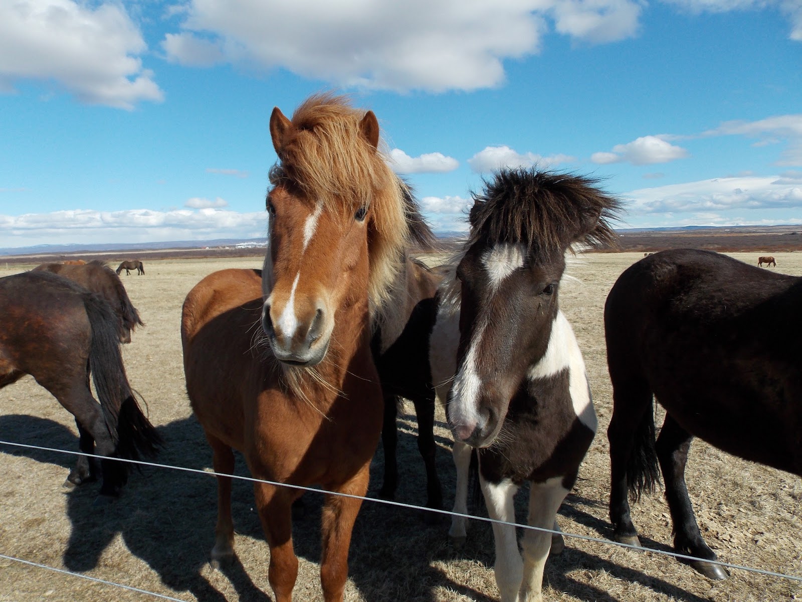
This might be my favorite photo of the day.
Our next stop was at an enormous two-tier waterfall. It was monstrous. That's really all there is to say about it. Also, in the distance behind the waterfall we could see one of the glaciers of Iceland, so that was pretty cool. Unfortunately the glacier was not on our tour list.

The second tier fell into a really deep gorge. We couldn't see exactly how deep because they keep you roped back pretty far.


The second tier of the waterfall and standing at one of the observation points.

Mountains with the glacier behind them. The glacier is the white, smooth, sloping thing behind the mountain peaks. It was hard to get a good picture.
After the waterfall - where we stopped to eat lamb soup in a tourist center and it was delicious - we started to head back toward Reykjavik. Our third-to-last stop was at a bunch of geysers. There are lots of small geysers all over Iceland because it's a volcanic island, but there's one area with lots of big geysers. The word "geyser" actually comes from a geyser in this area, an enormous one called Geysir. Geysir is dormant at the moment, but there is one big geyser that shoots off every 5-7 minutes and shoots almost as high as Old Faithful. You can also stand much closer to it than you can to Old Faithful. We watched it go off about four or five times. I'd never seen a geyser before, so I thought it was pretty cool.

Geysir, the inactive geyser. It used to shoot about 300 feet into the air. It's inactive now, but that doesn't meant that it will always be dormant.


The active geyser as it erupted. I got okay pictures, but I couldn't get my camera to take photos fast enough!


Still erupting and then the hole starting to re-fill with water as the steam cleared.
This whole area was steaming from the boiling water and bubbling. It seemed almost prehistoric.
The last two stops were quick. The first was a small waterfall that has a salmon ladder built next to it so the salmon can go upstream.

Waterfall (whose name means "horse's mane" because it looks a bit like a horse's mane) and the salmon ladder on the left.

Close-up of the salmon ladder.
And, finally, out last stop was at a volcanic crater. About 6500 years ago a volcano erupted and after it emptied it's magma chamber, it collapsed in on itself and formed a crater where it once stood. That was really cool to see as well, though unfortunately the light wasn't good so my pictures aren't that great.

The crater with a lake down in the middle. It was pretty big, but, like I said, I couldn't get great pictures because the shadows were bad.

Standing at the edge of the crater.
And that's that! That was the end of the tour. Afterward we came back to Reykjavik and ate ice cream and watched TV. Today has been a lazy morning. We're going to go eat something and then probably just wander around Reykjavik today. This evening we'll have to pack and get ready to go to the airport tomorrow. I can't believe I'll be back in the United States tomorrow! After eight months! Really crazy.
Maybe one more post tonight - and I'll need to do something to wrap up this blog. After eight months of writing it...seems weird to stop! But my life will be a whole lot less picture-worthy back in the United States, so there will probably be a lot less to share!
No comments:
Post a Comment